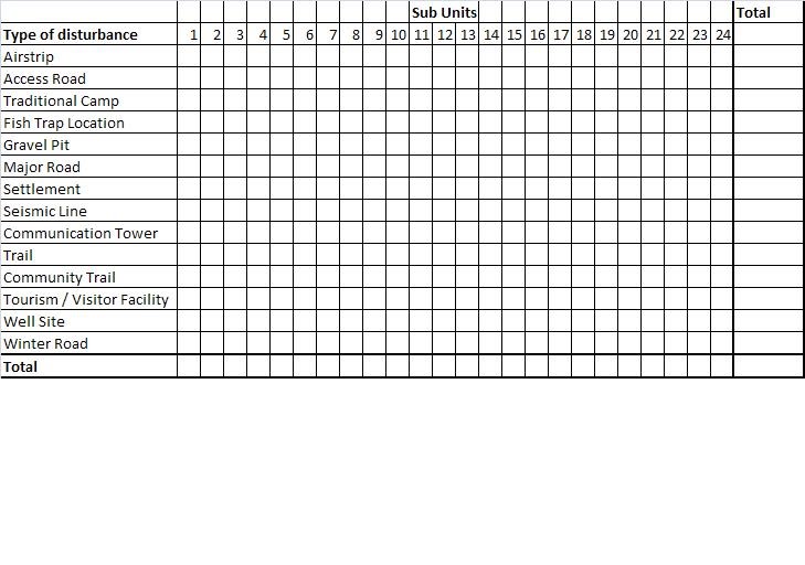
Assessment of the meff for the region will be slightly less detailed than anticipated. Given the timeframe, we may have to limit our analysis to two fragmentation geometries (FG). The first FG will offer a general measurement of the meff by including everything that is considered a disturbance in the landscape. The second FG will remove features that have the potential to be re-vegetated through natural processes, such as seismic lines. Our rationale behind this is that over time these features are much less significant barriers in the landscape, which may be worthy of attention of the meff is to be used in future scenario models. In addition to the meff, LD and SD will need to be measured in order to compare results between indicators. Tables with results will be created, similar to the image below:
What is the total amount of human-caused surface disturbance (SD) in each of the 24 sub units?
Results will be given in km2 of total surface disturbance per km2 of the sub unit's land cover and also the percentage of land covered by disturbances per sub unit.
A similar table will be made to show results of linear density for each of the sub units.
What is the linear density in each of the 24 sub units?
Results will be given in km per km2 of the sub unit's total land cover.
A similar table will be made to show results of the meff for both FGs. Also, a table will be made to compare results of the two meff measurements, the cross-boundary connection (CBC) and the CUT procedure.
The following sections of the report will give a detailed methodology of each step that was undertaken while manipulating the data given to us by the North Yukon Planning Commission. The purpose of this section is to give as much information as possible as to what has already been done and what the recommendations are for future analysis. Here is a brief overview of the sections:
1) Effective mesh size tool in ArcGIS
Instructions and use;
Outputs;
Current assessment of results.
2) Assessment of the NY scenarios report
Interpretation of initial data as it was received;
What needed to be done with data in order to get the desired results;
Potential questions or issues that still need to be adressed.
3) Fragmentation geometries
Possible useful combinations (recommendations);
Executed FGs.
4) Discussion and recommendations
Interpretation of the results;
Reflections on what still needs to be adressed (i.e. what's a smart path to take for someone that will carry on this project).
5) Warnings
All the issues and discrepancies encountered during this project.
Our goal is to make the transition process (from myself to the person that will pursue this project) as clear and concise as possible. Addressing what has been done and making recommendations as to how this project can be improved will hopefully help anyone who wishes to pursue this project.
No comments:
Post a Comment